- No16
Digital Collections Search Results
Creator
Royal Geographical Society (Great Britain)
Container / Volume
BRBL_00329
Published / Created
1911
Call Number
60bh 1911
Format
Digital Collection / Online / Cartographic / Maps & GIS
Found In
Access
Public
Alternative Title
Exploration of Africa

Creator
Wyld, James, 1812-1887
Container / Volume
BRBL_00327
Published / Created
[1875?]
Call Number
60 1875
Format
Digital Collection / Online / Cartographic / Maps & GIS
Found In
Access
Public
Alternative Title
Africa, Map shewing the various explorations in Africa, and Wyld's map showing the various explorations in Africa

Container / Volume
BRBL_00314
Published / Created
1886
Call Number
582 1886
Format
Digital Collection / Online / Cartographic / Maps & GIS
Found In
Access
Public

Container / Volume
BRBL_00382
Published / Created
1858
Call Number
736 1858
Format
Digital Collection / Online / Cartographic / Maps & GIS
Found In
Access
Public

Container / Volume
BRBL_00382
Published / Created
1858
Call Number
736 R246 1858
Format
Digital Collection / Online / Cartographic / Maps & GIS
Found In
Access
Public

Container / Volume
BRBL_00020
Published / Created
1794
Call Number
23 1808
Format
Digital Collection / Online / Cartographic / Maps & GIS
Found In
Access
Public

Creator
Faden, William, 1749-1836, Palmer, W. (William), 1739-1812, and Roberts, Henry, Lieut
Container / Volume
BRBL_00019
Published / Created
1784
Call Number
23 1784
Format
Digital Collection / Online / Cartographic / Maps & GIS
Found In
Access
Public
Alternative Title
Chart of the northwest coast of America and the northeast coast of Asia, explored in the years 1778

Container / Volume
BRBL_00667
Published / Created
Oct. 1783.
Call Number
906 1783
Format
Digital Collection / Online / Cartographic / Maps & GIS
Found In
Access
Public

Container / Volume
BRBL_00019
Published / Created
1794
Call Number
23 1794B
Format
Digital Collection / Online / Cartographic / Maps & GIS
Found In
Access
Public

Creator
Edward Stanford Ltd
Container / Volume
BRBL_00023B
Published / Created
1903
Call Number
2732 1903
Format
Digital Collection / Online / Cartographic / Maps & GIS
Found In
Access
Public

Creator
Wilkes, Charles, 1798-1877
Container / Volume
BRBL_00533
Published / Created
[1845?]
Call Number
80 1841A
Format
Digital Collection / Online / Cartographic / Maps & GIS
Found In
Access
Public
Subject (Name)
United States Exploring Expedition (1838-1842) and Wyld, James, 1812-1887

Container / Volume
BRBL_00390
Description
Originally folded in "Climbs & exploration in the Canadian Rockies" by Hugh E. M. Stutfield and J
Published / Created
1903. +
Call Number
739 R59 1902
Format
Digital Collection / Online / Cartographic / Maps & GIS
Found In
Access
Public
Alternative Title
Canadian Rocky Mountains and Climbs & exploration in the Canadian Rockies.

Creator
Arrowsmith, John, 1790-1873
Container / Volume
BRBL_00022
Description
of topography and some explorations. Sheet measures 69 x 54 cm.
Published / Created
1st. Jany. 1850.
Call Number
26 1850A
Format
Digital Collection / Online / Cartographic / Maps & GIS
Found In
Access
Public
Creator
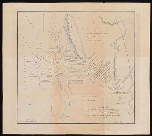
Arrowsmith, John, 1790-1873, cartographer
Description
From John Lort Stokes's Discoveries in Australia (1846). Includes index of counties and notes
Published / Created
Apl. 1st 1846.
Call Number
BrSides 2019 93
Format
Digital Collection / Online / Cartographic / Maps & GIS
Found In
Access
Public
Subject (Name)
Beagle Expedition--(1831-1836)--Maps. and Stokes, John Lort, 1811-1885. Discoveries in Australia.
Subject (Topic)
Counties--Australia--New South Wales--Maps., Counties--Australia--Western Australia--Maps., and Discoveries in geography

Creator
Bowles, Carington, 1724-1793, cartographer.
Description
the voyages of some important explorers of the second half of the 18th century, including Cook's first voyage.
Published / Created
May 1780.
Call Number
11 1780B
Format
Digital Collection / Online / Cartographic / Maps & GIS
Found In
Access
Public

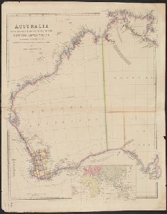
Creator
Arrowsmith, John, 1790-1873, cartographer
Description
in Australia : with an account of the coasts and rivers explored and surveyed during the voyage of H
Published / Created
1846
Call Number
BrSides 2019 95
Format
Digital Collection / Online / Cartographic / Maps & GIS
Found In
Access
Public