- No11
Digital Collections Search Results
Creator
Kibbe, A. F
Container / Volume
BRBL_00587
Description
of Congress at Washington." Includes inset of "Map of the state of Colorado." Library's copy stamped in lower
Published / Created
1881
Call Number
834 1881A
Format
Digital Collection / Online / Cartographic / Maps & GIS
Found In
Access
Public

Creator
Warner, William Horace
Container / Volume
BRBL_00608
Description
Includes text dated "May 1st, 1850" certifying map. Library's copy annotated in black ink on verso
Published / Created
[1850?]
Call Number
844 Sa14 1850
Format
Digital Collection / Online / Cartographic / Maps & GIS
Found In
Access
Public

Creator
Tanesse, I
Container / Volume
BRBL_00522
Description
Includes ill. of buildings, with name and date of construction for each. Library's copy without ill
Published / Created
1817
Call Number
795 N47 1817
Format
Digital Collection / Online / Cartographic / Maps & GIS
Found In
Access
Public

Creator
Bruff, Joseph Goldsborough, 1804-1889
Container / Volume
BRBL_00649
Description
of the 8th and 9th May 1846 -- Tampico and its environs -- Chart of the bay of Vera Cruz. Library's copies
Published / Created
1847
Call Number
88hc 1847A
Format
Digital Collection / Online / Cartographic / Maps & GIS
Found In
Access
Public

Container / Volume
BRBL_00646
Description
Association. Library's copy imperfect: Hole in center.
Published / Created
1913
Call Number
88 1913
Format
Digital Collection / Online / Cartographic / Maps & GIS
Access
Public

Creator
Hunt, Richard S
Container / Volume
BRBL_00524
Description
of the District Court of the Southern District of New York." Library's copy annotated in pencil and orange ink
Published / Created
[1841?]
Call Number
796 1841A
Format
Digital Collection / Online / Cartographic / Maps & GIS
Found In
Access
Public

Container / Volume
BRBL_00525
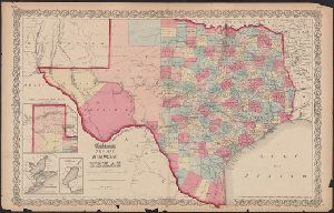
Description
not appear on Colton map dated 1857. Insets: Plan of the northern part of Te Library's copy annotated
Published / Created
[1859?]
Call Number
796 1859B
Format
Digital Collection / Online / Cartographic / Maps & GIS
Access
Public
Creator
Johnson, A. J. (Alvin Jewett), 1827-1884
Container / Volume
BRBL_00572
Description
Union Pacific-Central Pacific railroad shown incomplete; Laramie does not appear; an Library's copy
Published / Created
[between 1865 and 1868?]
Call Number
824fac 1865
Format
Digital Collection / Online / Cartographic / Maps & GIS
Found In
Access
Public

Creator
Tanner, Henry Schenck, 1786-1858
Container / Volume
BRBL_00601
Description
by land & water." Library's copy 2 mounted on linen, without cover. Relief shown by hachures. Shows
Published / Created
1849
Call Number
844 1849D
Format
Digital Collection / Online / Cartographic / Maps & GIS
Access
Public
