Digital Collections Search Results
Creator
Kissinger, Henry, 1923-2023
Container / Volume
Box 347, folder 7
Published / Created
1973-1974
Call Number
MS 1981
Format
Digital Collection / Online
Found In
Access
Public

Container / Volume
BRBL_00389
Published / Created
[c1925].
Call Number
739 1925
Format
Digital Collection / Online / Cartographic / Maps & GIS
Access
Public

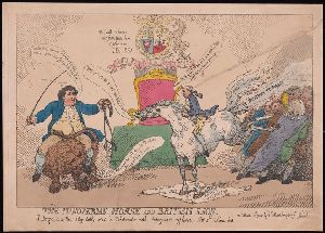
Description
Title etched below image. Date suggested by Isaac and by British Museum record for another popular
Published / Created
[between 1812 and 1817]
Call Number
812.00.00.128
Format
Digital Collection / Online / Images
Access
Public
Subject (Topic)
Hunters and British

Description
Title etched below image. Date suggested by Isaac and by British Museum record for another popular
Published / Created
[between 1812 and 1817]
Call Number
812.00.00.127
Format
Digital Collection / Online / Images
Access
Public
Subject (Topic)
Hunters and British

Creator
British Columbia. Dept. of Lands
Container / Volume
BRBL_00392
Published / Created
c1933.
Call Number
739G 1933
Format
Digital Collection / Online / Cartographic / Maps & GIS
Access
Public
Alternative Title
Map (British Columbia. Dept. of Lands) ; no. 1H. and Map / British Columbia Department of Lands ; no. 1H
Publisher
British Columbia Dept. of Lands,
Subject (Topic)
Mines and mineral resources--British Columbia--Maps

Creator
Bartolozzi, Francesco, 1727-1815, printmaker
Abstract
the quay in the [left] foreground, ships at sea and a fortification in the [left] background."--British
Description
, published by C. Knight in 1794, showing the identical scene in reverse. See British Museum online catalogue
Published / Created
[approximately 1794]
Call Number
794.00.00.74++
Format
Digital Collection / Online / Images
Found In
Access
Public
Subject (Topic)
Sailors, Social life and customs, Courtesans, British, and Piers & wharves

Creator
British Columbia. Dept. of Lands
Container / Volume
BRBL_00392
Published / Created
1929
Call Number
739G 1929C
Format
Digital Collection / Online / Cartographic / Maps & GIS
Access
Public

Creator
Violet, Thomas, active 1634-1662
Published / Created
[n.d.]
Call Number
Osborn fpb61
Format
Digital Collection / Online / Text
Access
Public
Subject (Topic)
Coins, British--Early works to 1800, Coins, English--Early works to 1800, and Money--Great Britain--Early works to 1800

Creator
Richards, Lloyd, 1919-2006
Container / Volume
Box 131, folder 1492
Published / Created
1985
Call Number
JWJ MSS 176
Format
Digital Collection / Online
Found In
Access
Yale Community Only

Container / Volume
BRBL_00393
Description
"Rand, McNally & Co.'s New Business Atlas Map of British Columbia." Includes inset map: Northern
Published / Created
1909
Call Number
739gme 1909
Format
Digital Collection / Online / Cartographic / Maps & GIS
Access
Public
Creator
Rowlandson, Thomas, 1756-1827, artist
Description
. For a similar study by Rowlandson for the same publication, see British Museum online catalogue, registration no
Published / Created
[1798]
Call Number
Drawings R79 no. 20 Box D207
Format
Digital Collection / Online / Images
Found In
Access
Public
Subject (Topic)
Soldiers, British, and Infantry

Creator
British Columbia. Dept. of Lands
Container / Volume
BRBL_00388
Published / Created
1911
Call Number
739 1911B
Format
Digital Collection / Online / Cartographic / Maps & GIS
Access
Public
Subject (Topic)
Railroads--British Columbia--Maps

Creator
British Columbia. Dept. of Lands
Container / Volume
BRBL_00388
Published / Created
1913
Call Number
739 1913B
Format
Digital Collection / Online / Cartographic / Maps & GIS
Access
Public
Subject (Topic)
Public lands--British Columbia--Maps

Creator
British Columbia. Dept. of Lands
Container / Volume
BRBL_00389
Published / Created
1942
Call Number
739 1942
Format
Digital Collection / Online / Cartographic / Maps & GIS
Found In
Access
Public
Subject (Topic)
Administrative and political divisions--British Columbia--Maps

Creator
British Columbia. Dept. of Lands
Container / Volume
BRBL_00392
Published / Created
1925
Call Number
739G 1925
Format
Digital Collection / Online / Cartographic / Maps & GIS
Found In
Access
Public

Creator
Dunbar, Rudolph, 1899-1988
Container / Volume
Box 1, folder 6
Published / Created
1959–1971
Call Number
JWJ MSS 174
Format
Digital Collection / Online
Found In
Access
Yale Community Only
Creator
Boswell, James, 1740-1795
Container / Volume
Box 17, folder 385
Published / Created
1813
Call Number
GEN MSS 89
Format
Digital Collection / Online
Found In
Access
Public

Creator
Royal Geographical Society (Great Britain)
Container / Volume
BRBL_00023A
Published / Created
1908
Call Number
26912 1908A
Format
Digital Collection / Online / Cartographic / Maps & GIS
Access
Public
Creator
Pettigrew, Thomas Joseph, 1791-1865
Container / Volume
Box 9, folder 426
Published / Created
1854 Nov 23
Call Number
OSB MSS 113
Format
Digital Collection / Online
Found In
Access
Public

Description
: The British seamen and their beloved Queen. For further information, consult library staff.
Published / Created
[approximately 1820?]
Call Number
File 763 820 N532
Format
Digital Collection / Online / Text
Access
Public

Container / Volume
BRBL_00040
Published / Created
1788
Call Number
319 1788
Format
Digital Collection / Online / Cartographic / Maps & GIS
Access
Public
Published / Created
ca. 1750]
Call Number
BrSides Cb4a 1750
Format
Digital Collection / Online / Text / Books
Access
Public

Published / Created
ca. 1750]
Call Number
BrSides Cb4a 1750
Format
Digital Collection / Online / Text / Books
Access
Public

Published / Created
173-?]
Call Number
NZ +735ca
Format
Digital Collection / Online / Text / Books
Access
Public

Creator
Fisher, Steven
Container / Volume
BRBL_00389
Description
"This map is from British Columbia's coast (the Canadian inside passage), Alaska Geographic, volume
Published / Created
c1986.
Call Number
739 1986
Format
Digital Collection / Online / Cartographic / Maps & GIS
Found In
Access
Public
Subject (Topic)
Coasts--British Columbia--Maps

Creator
Edinburgh Geographical Institute and John Bartholomew & Co
Container / Volume
BRBL_00040
Published / Created
[1875?]
Call Number
319 1875
Format
Digital Collection / Online / Cartographic / Maps & GIS
Found In
Access
Public
Subject (Topic)
Railroads--British Isles--Maps

Creator
Canada. Topographical Survey
Container / Volume
BRBL_00391
Published / Created
[1909]
Call Number
739CBF B386 1909
Format
Digital Collection / Online / Cartographic / Maps & GIS
Found In
Access
Public
Alternative Title
Part of the railway belt, British Columbia
Subject (Topic)
Triangulation--British Columbia--Maps

Creator
British Columbia. Dept. of Lands and Forests
Container / Volume
BRBL_00389
Published / Created
1947
Call Number
739 B41 1947
Format
Digital Collection / Online / Cartographic / Maps & GIS
Access
Public
Subject (Topic)
Coasts--British Columbia--Maps

Creator
British Columbia. Dept. of Lands and Forests
Container / Volume
BRBL_00389
Published / Created
1947
Call Number
739 G86 1947
Format
Digital Collection / Online / Cartographic / Maps & GIS
Found In
Access
Public
Subject (Topic)
Coasts--British Columbia--Maps

Creator
British Columbia. Dept. of Lands and Forests
Container / Volume
BRBL_00389
Published / Created
1943
Call Number
739 B41 1943
Format
Digital Collection / Online / Cartographic / Maps & GIS
Access
Public
Subject (Topic)
Coasts--British Columbia--Maps

Creator
Knight, Charles, 1743-1827?, printmaker
Description
Title from text below image. Companion print to: British plenty.
Published / Created
[1 January 1794]
Call Number
794.01.01.11++
Format
Digital Collection / Online / Images
Found In
Access
Public
Subject (Topic)
British, Sailors, Seduction, and Pineapples

Creator
Bretherton, James, approximately 1730-1806, printmaker
Abstract
"A standing man facing left with wig and sword."--British Museum online catalogue
Published / Created
[29 March 1772]
Call Number
Folio 75 B87 770 (Oversize)
Format
Digital Collection / Online / Images
Access
Public
Subject (Topic)
Clothing & dress, Dandies, and British

Creator
Wyld, James, 1812-1887
Container / Volume
BRBL_00040
Published / Created
[187-?]
Call Number
319 1872
Format
Digital Collection / Online / Cartographic / Maps & GIS
Found In
Access
Public
Subject (Topic)
Geology--British Isles--Maps

Creator
H.M. Gousha Company
Container / Volume
BRBL_00393
Description
Idaho, and northwestern Montana. At head of title: Shell. Directory of radio stations in British
Published / Created
1939
Call Number
739gmb 1939
Format
Digital Collection / Online / Cartographic / Maps & GIS
Access
Public
Alternative Title
Shell road map, British Columbia
Subject (Topic)
Roads--British Columbia--Maps

Creator
Pound, Ezra, 1885-1972
Container / Volume
Box 110, folder 4649
Published / Created
[1934]
Call Number
YCAL MSS 43
Format
Digital Collection / Online
Found In
Access
Public

Creator
Butts, Mary, 1890-1937
Container / Volume
Box 5, folder 84
Published / Created
n.d.
Call Number
GEN MSS 487
Format
Digital Collection / Online
Found In
Access
Public

Creator
Dunbar, Rudolph, 1899-1988
Container / Volume
Box 3, folder 57
Published / Created
1947–1973
Call Number
JWJ MSS 174
Format
Digital Collection / Online
Found In
Access
Yale Community Only
Creator
Canada. Dept. of the Interior
Container / Volume
BRBL_00389
Published / Created
1923
Call Number
739 G45 1923
Format
Digital Collection / Online / Cartographic / Maps & GIS
Access
Public

Creator
Rowlandson, Thomas, 1756-1827, printmaker.
Container / Volume
Vol. 1 (Box 2 of 2) | Folder I-54
Description
"227." Printmaker from British Museum catalogue. Text below title: A scene in a new play lately acted
Published / Created
1784 March 31
Call Number
Auchincloss Rowlandson v. 1
Format
Digital Collection / Online / Images
Found In
Access
Public
Published / Created
[1620s]
Call Number
Osborn fb229
Format
Digital Collection / Online / Text / Archives or Manuscripts
Found In
Access
Public

Creator
British Columbia. Dept. of Lands and Works
Container / Volume
BRBL_00391
Published / Created
1903
Call Number
739 Y12 1903
Format
Digital Collection / Online / Cartographic / Maps & GIS
Found In
Access
Public
Subject (Topic)
Mining districts--British Columbia--Maps

Creator
British Columbia. Dept. of Lands
Container / Volume
BRBL_00388
Published / Created
1912
Call Number
739 1912R
Format
Digital Collection / Online / Cartographic / Maps & GIS
Found In
Access
Public

Creator
Rand McNally and Company
Container / Volume
BRBL_00388
Description
"British Columbia Railroads"--Lower right corner. "Copyright, 1895, by Rand, McNally & Co." "Rand
Published / Created
1898
Call Number
739 1898A
Format
Digital Collection / Online / Cartographic / Maps & GIS
Found In
Access
Public
Alternative Title
Rand, McNally & Co.'s indexed indexed atlas of the world map of British Columbia
Subject (Topic)
Mining districts--British Columbia--Maps

Creator
Edward Stanford Ltd
Container / Volume
BRBL_00023B
Published / Created
1903
Call Number
2732 1903
Format
Digital Collection / Online / Cartographic / Maps & GIS
Found In
Access
Public
Publisher
Published by Edward Stanford for the British North Borneo Company,
Subject (Name)
British North Borneo Chartered Company

Creator
Canada. Dept. of the Interior
Container / Volume
BRBL_00393
Published / Created
1913
Call Number
739gme 1913
Format
Digital Collection / Online / Cartographic / Maps & GIS
Found In
Access
Public
Subject (Topic)
Land tenure--British Columbia--Maps

Creator
MacLeish, Archibald, 1892-1982
Container / Volume
Box 17, folder 278
Published / Created
1961 Jul 7
Call Number
YCAL MSS 38
Format
Digital Collection / Online
Found In
Access
Yale Community Only
Container / Volume
BRBL_00042
Published / Created
1908
Call Number
319gm 1908
Format
Digital Collection / Online / Cartographic / Maps & GIS
Found In
Access
Public

Container / Volume
BRBL_00690
Published / Created
1755]
Call Number
755 1755A
Format
Digital Collection / Online / Cartographic / Maps & GIS
Found In
Access
Public
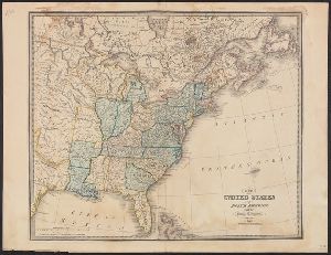
Alternative Title
Map of the British and French Plantations in North America.

Container / Volume
BRBL_00440
Published / Created
1832
Call Number
755 1832
Format
Digital Collection / Online / Cartographic / Maps & GIS
Found In
Access
Public
Container / Volume
BRBL_00440
Published / Created
1829
Call Number
755 1829
Format
Digital Collection / Online / Cartographic / Maps & GIS
Found In
Access
Public