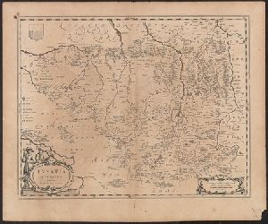
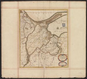
- No63
Digital Collections Search Results
Container / Volume
BRBL_00146
Published / Created
[1640?]
Call Number
3685 1640
Format
Digital Collection / Online / Cartographic / Maps & GIS
Found In
Access
Public
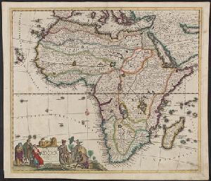
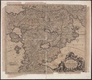
Creator
Danckerts, Justus, d. 1692
Container / Volume
BRBL_00322
Description
"Cum privilegio." Author is either Justus Danckerts the younger (d. 1692) or Justus Danckerts
Published / Created
ca. 1680]
Call Number
60 1680
Format
Digital Collection / Online / Cartographic / Maps & GIS
Found In
Access
Public
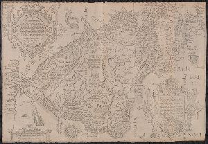
Creator
Langren, Arnold Florent van, 1580-1644, cartographer
Container / Volume
BRBL_00661
Published / Created
[1638]
Call Number
90 1638
Format
Digital Collection / Online / Cartographic / Maps & GIS
Found In
Access
Public
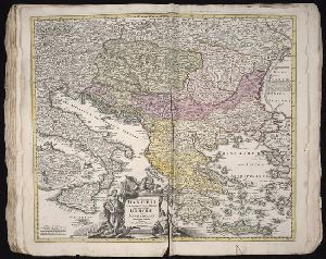
Creator
Broen, Joannes de, engraver, Penez, Alexander, and Wolfgang, Abraham, fl. 1658-1694
Container / Volume
BRBL_00089
Published / Created
ca. 1680?]
Call Number
3371 1735
Format
Digital Collection / Online / Cartographic / Maps & GIS
Found In
Access
Public

Creator
Homann, Johann Baptist, 1663-1724
Published / Created
1720?
Call Number
1975 Folio 31
Format
Digital Collection / Online / Cartographic
Found In
Access
Public
Creator
Homann, Johann Baptist, 1663-1724
Published / Created
1720?
Call Number
1973 Folio 30
Format
Digital Collection / Online / Cartographic
Found In
Access
Public

Container / Volume
BRBL_00113
Published / Created
1680]
Call Number
356 1680A
Format
Digital Collection / Online / Cartographic / Maps & GIS
Found In
Access
Public
Container / Volume
BRBL_00001
Published / Created
1680?]
Call Number
1an 1680
Format
Digital Collection / Online / Cartographic / Maps & GIS
Found In
Access
Public
Creator
Mortier, Pierre, author
Container / Volume
BRBL_00278
Call Number
51 1705
Format
Digital Collection / Online / Cartographic / Maps & GIS
Found In
Access
Public

Creator
Hase, Johann Matthias, 1684-1742, cartographer. http://id.loc.gov/authorities/names/n85044571
Published / Created
1739
Call Number
1973 Folio 30
Format
Digital Collection / Online / Cartographic / Maps & GIS
Found In
Beinecke Rare Book and Manuscript Library > Imperii Russici et Tatariae universae tam majoris et Asiaticae, qvam minoris et Europaeae tabvla / ex recentissimis et probatissimis monumentis et relationibus concin[n]ata, et ad legitimas projectionum geographic. regulas plane exacta opera Ioh Matthiae Hasii, Math. P.P. ... ; R.A. Schneider, sc.
Access
Public
Subject (Name)
Anna,--Empress of Russia,--1693-1740.--http://id.loc.gov/authorities/names/n50051926, Homann Erben (Firm), publisher. http://id.loc.gov/authorities/names/n80051855, and Schneider, R.A., engraver. http://id.loc.gov/authorities/names/no2012106139
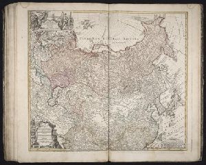
Creator
Braun, Georg, 1540 or 1541-1622
Container / Volume
BRBL_00736
Published / Created
1572. and 1882-1883.
Call Number
32 L84 1572/1882
Format
Digital Collection / Online / Cartographic / Maps & GIS
Access
Public
Subject (Name)
Hogenberg, Frans, approximately 1539-1590, joint author and London Topographical Society

Creator
Jansson, Jan, 1588-1664, cartographer, publisher.
Published / Created
[between 1652 and 1684]
Call Number
BrSides Double Folio 2019 100
Format
Digital Collection / Online / Cartographic / Maps & GIS
Found In
Access
Public
Subject (Name)
Horn, Georg, 1620-1670, compiler. http://id.loc.gov/authorities/names/no00023675

Creator
Jansson, Jan, 1588-1664, cartographer, publisher.
Published / Created
[between 1652 and 1684]
Call Number
BrSides Double Folio 2019 100
Format
Digital Collection / Online / Cartographic / Maps & GIS
Found In
Access
Public
Subject (Name)
Horn, Georg, 1620-1670, compiler. http://id.loc.gov/authorities/names/no00023675

Creator
Jansson, Jan, 1588-1664, cartographer, publisher.
Published / Created
[between 1652 and 1684]
Call Number
BrSides Double Folio 2019 100
Format
Digital Collection / Online / Cartographic / Maps & GIS
Found In
Access
Public
Subject (Name)
Horn, Georg, 1620-1670, compiler. http://id.loc.gov/authorities/names/no00023675

Creator
Ogilby, John, 1600-1676
Container / Volume
BRBL_00338
Published / Created
1670]
Call Number
64 1670
Format
Digital Collection / Online / Cartographic / Maps & GIS
Found In
Access
Public
Publisher
Printed by T. Johnson for the author,

Creator
Ogilby, John, 1600-1676
Container / Volume
BRBL_00347
Published / Created
1670]
Call Number
66 1670A
Format
Digital Collection / Online / Cartographic / Maps & GIS
Found In
Access
Public
Publisher
Printed by T. Johnson for the author,

Creator
Ogilby, John, 1600-1676
Container / Volume
BRBL_00347
Published / Created
1670]
Call Number
66 1670
Format
Digital Collection / Online / Cartographic / Maps & GIS
Found In
Access
Public
Publisher
Printed by T. Johnson for the author,

Creator
Ogilby, John, 1600-1676
Container / Volume
BRBL_00348
Published / Created
1670]
Call Number
67 1670
Format
Digital Collection / Online / Cartographic / Maps & GIS
Access
Public
Publisher
Printed by T. Johnson for the author,

Creator
Ogilby, John, 1600-1676
Container / Volume
BRBL_00345
Published / Created
1670]
Call Number
655 1670
Format
Digital Collection / Online / Cartographic / Maps & GIS
Found In
Access
Public
Publisher
Printed by T. Johnson for the author,

Creator
Ogilby, John, 1600-1676 and Ogilby, John, 1600-1676. Africa, being an accurate description of the regions of Egypt, Barbary
Published / Created
1670]
Call Number
214 1670
Format
Digital Collection / Online / Cartographic / Maps & GIS
Access
Public
Publisher
Printed by T. Johnson for the author,

Creator
Ogilby, John, 1600-1676 and Ogilby, John, 1600-1676. Africa, being an accurate description of the regions of Egypt, Barbary
Published / Created
1670]
Call Number
213 1670
Format
Digital Collection / Online / Cartographic / Maps & GIS
Found In
Access
Public
Publisher
Printed by T. Johnson for the author,

Creator
Ogilby, John, 1600-1676 and Ogilby, John, 1600-1676. Africa, being an accurate description of the regions of Egypt, Barbary
Container / Volume
BRBL_00028
Published / Created
1670]
Call Number
299 1670
Format
Digital Collection / Online / Cartographic / Maps & GIS
Access
Public
Publisher
Printed by T. Johnson for the author,

- « Previous
- 1
- 2
- 3
- Next »