Digital Collections Search Results
Creator
Betts, John, fl. 1844-1863
Container / Volume
BRBL_00371
Published / Created
[18--?]
Call Number
71 18XX
Format
Digital Collection / Online / Cartographic / Maps & GIS
Access
Public

Container / Volume
BRBL_00644
Published / Created
1817?]
Call Number
88 1817
Format
Digital Collection / Online / Cartographic / Maps & GIS
Access
Public
Container / Volume
BRBL_00644
Published / Created
1814?]
Call Number
88 1814
Format
Digital Collection / Online / Cartographic / Maps & GIS
Access
Public

Call Number
1974 +231
Format
Digital Collection / Online / Cartographic
Access
Public

Creator
Bowles, Carington, 1724-1793, Bowles, John, 1701-1779, Delarochette, L. (Louis), 1731-1802, creator, and Palairet, Jean, 1697-1774
Description
. Includes historical notes and table of Methodical divisions of North America. LC Maps of North America
Published / Created
1765
Call Number
2003 Folio 85
Format
Digital Collection / Online / Cartographic
Access
Public

Creator
Hooker, William and Jones, Benjamin
Call Number
1974 +231
Format
Digital Collection / Online / Cartographic
Access
Public

Creator
Hall, Sidney
Published / Created
[between 1825 and 1845]
Call Number
BrSides 2018 137
Format
Digital Collection / Online / Cartographic / Maps & GIS
Access
Public
Subject (Topic)
Indians of North America--Maps

Creator
Wilkinson, Robert, -approximately 1825
Container / Volume
BRBL_00369
Published / Created
1823 August 12
Call Number
71 1823
Format
Digital Collection / Online / Cartographic / Maps & GIS
Access
Public

Creator
Hewitt, N. R
Container / Volume
BRBL_00644
Published / Created
1821?]
Call Number
88 1821
Format
Digital Collection / Online / Cartographic / Maps & GIS
Access
Public

Creator
Gibson, J. (John)
Container / Volume
BRBL_00362
Published / Created
1753?]
Call Number
71 1753A
Format
Digital Collection / Online / Cartographic / Maps & GIS
Access
Public

Container / Volume
BRBL_00371
Description
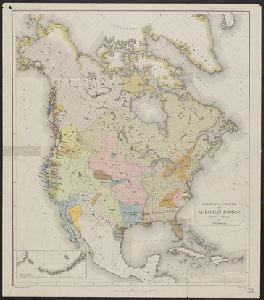
Includes list. Shows North America divided among 111 tribes. Title devised by cataloger.
Published / Created
19--?]
Call Number
71ED 1850
Format
Digital Collection / Online / Cartographic / Maps & GIS
Access
Public
Subject (Topic)
Indians of North America--Maps

Creator
Thomson, John, geographer
Container / Volume
BRBL_00368
Published / Created
1814
Call Number
71 1814
Format
Digital Collection / Online / Cartographic / Maps & GIS
Access
Public

Creator
Johnson and Ward
Container / Volume
BRBL_00371
Published / Created
1866?]
Call Number
71 1866
Format
Digital Collection / Online / Cartographic / Maps & GIS
Access
Public
Alternative Title
North America

Container / Volume
BRBL_00436
Published / Created
1798
Call Number
755 1798
Format
Digital Collection / Online / Cartographic / Maps & GIS
Access
Public

Container / Volume
BRBL_00437
Published / Created
1796
Call Number
755 1802
Format
Digital Collection / Online / Cartographic / Maps & GIS
Found In
Access
Public

Published / Created
1802
Call Number
Zc20 805peb
Format
Digital Collection / Online / Cartographic
Found In
Access
Public
Subject (Topic)
Indians of North America

Creator
Weller, Edward, d. 1884
Call Number
Zc90 859ka
Format
Digital Collection / Online / Cartographic
Found In
Access
Public
Subject (Topic)
Indians of North America

Creator
R. B., 1632?-1725?
Call Number
Taylor 388
Format
Digital Collection / Online / Cartographic
Access
Public
Subject (Topic)
Indians of North America

Creator
Coronelli, Vincenzo, 1650-1718
Container / Volume
BRBL_00735
Published / Created
1693-1707]
Call Number
71 1693 31
Format
Digital Collection / Online / Cartographic / Maps & GIS
Access
Public
Creator
Smith, J. Calvin (John Calvin)
Container / Volume
BRBL_00370
Published / Created
1851
Call Number
71 1851A
Format
Digital Collection / Online / Cartographic / Maps & GIS
Access
Public
Creator
Smith, J. Calvin (John Calvin)
Container / Volume
BRBL_00370
Published / Created
1850
Call Number
71 1850A
Format
Digital Collection / Online / Cartographic / Maps & GIS
Access
Public

Creator
Smith, J. Calvin (John Calvin)
Container / Volume
BRBL_00370
Published / Created
1849
Call Number
71 1849A
Format
Digital Collection / Online / Cartographic / Maps & GIS
Access
Public

Creator
Dunn, Samuel
Published / Created
1774
Call Number
Cb23 27
Format
Digital Collection / Online / Cartographic
Found In
Access
Public
Creator
Pownall, Thomas, 1722-1805
Container / Volume
BRBL_00366
Description
An issue of the Pownall map of North America and the West Indies; appears similar to the 1783
Published / Created
between 1783 and 1799?]
Call Number
71 1785C
Format
Digital Collection / Online / Cartographic / Maps & GIS
Found In
Access
Public
Alternative Title
Map of North America and the West Indies
Container / Volume
BRBL_00690
Published / Created
1755]
Call Number
755 1755A
Format
Digital Collection / Online / Cartographic / Maps & GIS
Found In
Access
Public
Alternative Title
Map of the British and French Plantations in North America.

Container / Volume
BRBL_00440
Published / Created
1832
Call Number
755 1832
Format
Digital Collection / Online / Cartographic / Maps & GIS
Found In
Access
Public
Container / Volume
BRBL_00440
Published / Created
1829
Call Number
755 1829
Format
Digital Collection / Online / Cartographic / Maps & GIS
Found In
Access
Public
Container / Volume
BRBL_00689
Published / Created
1759]
Call Number
734 Q31 1759
Format
Digital Collection / Online / Cartographic / Maps & GIS
Found In
Access
Public
Creator
J. & C. Walker (Firm)
Container / Volume
BRBL_00374
Published / Created
1834
Call Number
73 1834
Format
Digital Collection / Online / Cartographic / Maps & GIS
Found In
Access
Public

Creator
Anville, Jean Baptiste Bourguignon d', 1697-1782
Container / Volume
BRBL_00364
Published / Created
17--?]
Call Number
71 1769A
Format
Digital Collection / Online / Cartographic / Maps & GIS
Access
Public

Container / Volume
BRBL_00431
Published / Created
1777]
Call Number
755 1777F
Format
Digital Collection / Online / Cartographic / Maps & GIS
Found In
Access
Public

Call Number
1976 1233
Format
Digital Collection / Online / Cartographic
Found In
Access
Public
Alternative Title
North America

Container / Volume
BRBL_00432
Published / Created
[1778?]
Call Number
755 1778H
Format
Digital Collection / Online / Cartographic / Maps & GIS
Found In
Access
Public

Creator
Powell, John Wesley, 1834-1902
Container / Volume
BRBL_00371
Published / Created
1891]
Call Number
71ef 1890
Format
Digital Collection / Online / Cartographic / Maps & GIS
Found In
Access
Public
Subject (Topic)
Indians of North America--Languages--Maps and Indians of North America--Maps
Creator
Geological Survey (U.S.)
Container / Volume
BRBL_00364
Published / Created
193-?]
Call Number
71 1755Q
Format
Digital Collection / Online / Cartographic / Maps & GIS
Found In
Access
Public
Subject (Name)
Great Britain.--Treaties, etc.--United States,--1783 Sept. 3--Maps--Early works to 1800--Facsimiles, Jefferys and Faden, London, and Mitchell, John, 1711-1768. Map of the British and French dominions in North America

Creator
Society for the Diffusion of Useful Knowledge (Great Britain)
Container / Volume
BRBL_00547
Published / Created
July. 1st 1833.
Call Number
806 1833
Format
Digital Collection / Online / Cartographic / Maps & GIS
Found In
Access
Public

Creator
Russell, John, fl. 1733-1795
Published / Created
1794 July 26
Call Number
1986 102
Format
Digital Collection / Online / Cartographic
Found In
Access
Public

Container / Volume
BRBL_00726
Published / Created
1774
Call Number
71 1774
Format
Digital Collection / Online / Cartographic / Maps & GIS
Found In
Access
Public

Container / Volume
BRBL_00438
Published / Created
1809
Call Number
755 1809
Format
Digital Collection / Online / Cartographic / Maps & GIS
Found In
Access
Public

Creator
Catlin, George, 1796-1872
Published / Created
1848
Call Number
Zc12 +841cabj
Format
Digital Collection / Online / Cartographic
Found In
Access
Public
Subject (Topic)
Indians of North America --Pictorial works, Indians of North America --Relocation, and Indians of North America --West (U.S.)

Call Number
Ck44 23
Format
Digital Collection / Online / Cartographic
Access
Public
Subject (Topic)
Indians of North America and Swedes --America
Call Number
Pequot B28
Format
Digital Collection / Online / Images
Access
Public
Subject (Topic)
Indians of North America and Iroquois Indians

Call Number
Taylor 257
Format
Digital Collection / Online / Cartographic
Found In
Access
Public
Subject (Topic)
Indians of North America --Canada and Indians of North America --Clothing

Creator
United States. Bureau of Indian Affairs
Container / Volume
BRBL_00409
Published / Created
1907
Call Number
75ea 1907A
Format
Digital Collection / Online / Cartographic / Maps & GIS
Found In
Access
Public
Subject (Topic)
Indian reservations--North America--Maps and Indians of North America--Land tenure--Maps

Creator
United States. Bureau of Indian Affairs
Container / Volume
BRBL_00410
Published / Created
1904
Call Number
75ed 1904
Format
Digital Collection / Online / Cartographic / Maps & GIS
Found In
Access
Public
Subject (Topic)
Indian reservations--North America--Maps and Indians of North America--Land tenure--Maps

Creator
Kitchin, Thomas, d. 1784
Container / Volume
BRBL_00366
Published / Created
178-?]
Call Number
71 1784B
Format
Digital Collection / Online / Cartographic / Maps & GIS
Found In
Access
Public

Creator
Neele, Samuel John, 1758-1824
Published / Created
1798
Call Number
Egf +759c
Format
Digital Collection / Online / Cartographic / Books
Found In
Access
Public

Creator
Morse, Jedidiah, 1761-1826
Published / Created
1797
Call Number
GA405 +W44 (LC)
Format
Digital Collection / Online / Cartographic
Found In
Access
Public

Creator
Conder, Thomas, 1746 or 1747-1831
Container / Volume
BRBL_00366
Published / Created
1782?]
Call Number
71 1782A
Format
Digital Collection / Online / Cartographic / Maps & GIS
Found In
Access
Public

Creator
E. & G.W. Blunt (Firm)
Container / Volume
BRBL_00648
Published / Created
1849
Call Number
88cea 1849
Format
Digital Collection / Online / Cartographic / Maps & GIS
Found In
Access
Public
