- No[remove]72
Digital Collections Search Results
Container / Volume
BRBL_00010S
Published / Created
1878?]
Call Number
11hcf 1919C-1-1
Format
Digital Collection / Online / Cartographic / Maps & GIS
Found In
Access
Public
Creator
C.S. Hammond & Company
Container / Volume
BRBL_00037B
Published / Created
[ca. 1920]
Call Number
30fd 1920
Format
Digital Collection / Online / Cartographic / Maps & GIS
Found In
Access
Public
Subject (Topic)
World War, 1914-1918--Treaties

Creator
Edinburgh Geographical Institute and John Bartholomew and Son
Container / Volume
BRBL_00032A
Published / Created
[1920?].
Call Number
30 1920C
Format
Digital Collection / Online / Cartographic / Maps & GIS
Found In
Access
Public
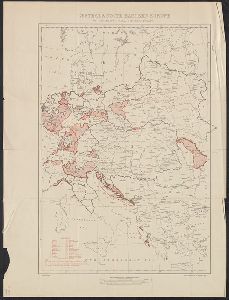
Alternative Title
Bartholomew's general map of Europe, showing boundaries of states according to treaties.

Container / Volume
BRBL_00034B
Published / Created
1918
Call Number
304fd 1818
Format
Digital Collection / Online / Cartographic / Maps & GIS
Found In
Access
Public
Creator
Disturnell, John, 1801-1877
Container / Volume
BRBL_00645
Description
"Reproduced in 1935 to accompany ʻTreaties and other international acts of the United States
Published / Created
1935
Call Number
88 1847H
Format
Digital Collection / Online / Cartographic / Maps & GIS
Found In
Access
Public
Subject (Name)
A. Hoen & Co and United States. Treaties, etc
Subject (Topic)
United States--Foreign relations--Treaties--Maps

Container / Volume
BRBL_00399
Published / Created
1848?]
Call Number
75 1848C
Format
Digital Collection / Online / Cartographic / Maps & GIS
Found In
Access
Public
Container / Volume
BRBL_00399
Published / Created
1848?]
Call Number
75 1848B
Format
Digital Collection / Online / Cartographic / Maps & GIS
Found In
Access
Public

Creator
Edward Stanford Ltd
Container / Volume
BRBL_00257
Description
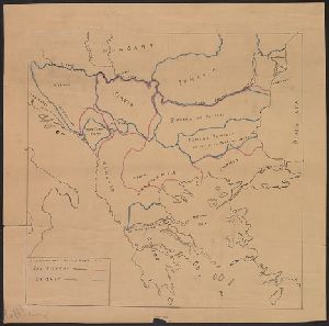
Inset: Map of Armenia to illustrate Article XIX of the Treaty of San Stefano. Map of southeastern
Published / Created
1878
Call Number
44FD 1878A
Format
Digital Collection / Online / Cartographic / Maps & GIS
Found In
Access
Public
Alternative Title
Map to illustrate the Treaty of San Stefano and Stanford's map of south-eastern Europe and Armenia illustrating the Treaty of San Stefano, the new
Subject (Topic)
Eastern question (Balkan)--Maps and Treaty of San Stefano--(1878)--Maps

Creator
Great Britain. Ordnance Survey
Container / Volume
BRBL_00296
Published / Created
1913
Call Number
56 1913
Format
Digital Collection / Online / Cartographic / Maps & GIS
Found In
Access
Public

Creator
Great Britain. Ordnance Survey
Container / Volume
BRBL_00298
Published / Created
1910
Call Number
56gm 1910
Format
Digital Collection / Online / Cartographic / Maps & GIS
Found In
Access
Public

Creator
Wyld, James, 1790-1836
Container / Volume
BRBL_00155
Published / Created
[1874]
Call Number
38 1874
Format
Digital Collection / Online / Cartographic / Maps & GIS
Found In
Access
Public

Creator
J.H. Colton & Co
Container / Volume
BRBL_00570
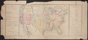
Description
, Kansas, Iowa, and Missouri, and map of "Territory acquired from Mexico by the Gadsden Treaty." Relief
Published / Created
1857
Call Number
824 1857D
Format
Digital Collection / Online / Cartographic / Maps & GIS
Access
Public
Alternative Title
Territory acquired from Mexico by the Gadsden Treaty.
Subject (Name)
Mexico.--Treaties, etc.--United States,--1853 Dec. 30--Maps

Creator
J.H. Colton & Co
Container / Volume
BRBL_00570
Description
., and insets of the United States and "Territory acquired from Mexico by the Gadsden Treaty." Relief shown
Published / Created
[1855?]
Call Number
824 1855A
Format
Digital Collection / Online / Cartographic / Maps & GIS
Access
Public
Alternative Title
Territory acquired from Mexico by the Gadsden Treaty.
Subject (Name)
Mexico.--Treaties, etc.--United States,--1853 Dec. 30--Maps

Creator
J.H. Colton & Co
Container / Volume
BRBL_00570
Description
Mexico by the Gadsden Treaty, 1854." Relief shown by hachures.
Published / Created
19--?]
Call Number
824 1854B
Format
Digital Collection / Online / Cartographic / Maps & GIS
Access
Public
Alternative Title
Map of the territory acquired from Mexico by the Gadsden Treaty, 1854.
Subject (Name)
Mexico.--Treaties, etc.--United States,--1853 Dec. 30--Maps

Creator
J.H. Colton & Co
Container / Volume
BRBL_00570
Description
Mexico by the Gadsden Treaty, 1854." Relief shown by hachures.
Published / Created
[1854?]
Call Number
824 1854A
Format
Digital Collection / Online / Cartographic / Maps & GIS
Access
Public
Alternative Title
Map of the territory acquired from Mexico by the Gadsden Treaty, 1854.
Subject (Name)
Mexico.--Treaties, etc.--United States,--1853 Dec. 30--Maps

Creator
National Geographic Society (U.S.)
Container / Volume
BRBL_00032B
Published / Created
1949
Call Number
30 1949
Format
Digital Collection / Online / Cartographic / Maps & GIS
Found In
Access
Public

Creator
Royal Geographical Society (Great Britain)
Container / Volume
BRBL_00256
Published / Created
1914
Call Number
44 1914A
Format
Digital Collection / Online / Cartographic / Maps & GIS
Found In
Access
Public

Container / Volume
BRBL_00010L
Call Number
11hcf 1919-53
Format
Digital Collection / Online / Cartographic / Maps & GIS
Found In
Access
Public
Subject (Topic)
Treaty of London--(1915), World War, 1914-1918--Diplomatic history, World War, 1914-1918--Territorial que, World War, 1914-1918--Territorial questions--Croatia, and World War, 1914-1918--Territorial questions--Italy

Container / Volume
BRBL_00434
Published / Created
1783
Call Number
755 1783B
Format
Digital Collection / Online / Cartographic / Maps & GIS
Found In
Access
Public

Container / Volume
BRBL_00436
Published / Created
1796
Call Number
755 1796
Format
Digital Collection / Online / Cartographic / Maps & GIS
Found In
Access
Public

Container / Volume
BRBL_00436
Published / Created
1794
Call Number
755 1794C
Format
Digital Collection / Online / Cartographic / Maps & GIS
Found In
Access
Public

Container / Volume
BRBL_00436
Published / Created
1794
Call Number
755 1794C
Format
Digital Collection / Online / Cartographic / Maps & GIS
Found In
Access
Public

Container / Volume
BRBL_00434
Published / Created
1783
Call Number
755 1783A
Format
Digital Collection / Online / Cartographic / Maps & GIS
Found In
Access
Public

Container / Volume
BRBL_00434
Published / Created
1783
Call Number
755 1783A
Format
Digital Collection / Online / Cartographic / Maps & GIS
Found In
Access
Public

- « Previous
- 1
- 2
- 3
- Next »