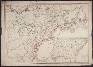
- No67
Digital Collections Search Results
Creator
Popple, Henry, -1743
Container / Volume
BRBL_00426
Published / Created
[ca. 1741]
Call Number
755 1734A
Format
Digital Collection / Online / Cartographic / Maps & GIS
Found In
Access
Public

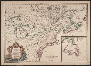
Creator
Popple, Henry, -1743
Container / Volume
BRBL_00426
Published / Created
[ca. 1741]
Call Number
755 1734B
Format
Digital Collection / Online / Cartographic / Maps & GIS
Found In
Access
Public

Creator
Popple, Henry, -1743
Container / Volume
BRBL_00697
Published / Created
[ca. 1741]
Call Number
89 1733
Format
Digital Collection / Online / Cartographic / Maps & GIS
Found In
Access
Public

Creator
Popple, Henry, -1743
Container / Volume
BRBL_00693
Published / Created
[ca. 1741]
Call Number
85 1760A
Format
Digital Collection / Online / Cartographic / Maps & GIS
Found In
Access
Public

Creator
Popple, Henry, -1743
Container / Volume
BRBL_00687
Published / Created
[ca. 1741]
Call Number
71 1741
Format
Digital Collection / Online / Cartographic / Maps & GIS
Found In
Access
Public

Creator
Popple, Henry, -1743
Container / Volume
BRBL_00636
Published / Created
[ca. 1741]
Call Number
85 1734
Format
Digital Collection / Online / Cartographic / Maps & GIS
Found In
Access
Public

Creator
Probst, Johann Michael, -1809
Container / Volume
BRBL_00366
Published / Created
Ao. MDCCLXXXII [1782]
Call Number
71 1782B
Format
Digital Collection / Online / Cartographic / Maps & GIS
Found In
Access
Public
Subject (Name)
Popple, Henry, -1743. Map of the British Empire in America and Probst, Jean George

Container / Volume
BRBL_00428
Published / Created
1756
Call Number
755 1756
Format
Digital Collection / Online / Cartographic / Maps & GIS
Found In
Access
Public
Subject (Topic)
British--North America--Maps--Early works to 1800 and French--North America--Maps--Early works to 1800
Container / Volume
BRBL_00428
Published / Created
1756
Call Number
755 1756A
Format
Digital Collection / Online / Cartographic / Maps & GIS
Found In
Access
Public
Subject (Topic)
British--North America--Maps--Early works to 1800 and French--North America--Maps--Early works to 1800

Creator
Mitchell, John, 1711-1768
Container / Volume
BRBL_00365
Published / Created
1777?]
Call Number
71 1777C
Format
Digital Collection / Online / Cartographic / Maps & GIS
Found In
Access
Public
Subject (Topic)
British--America--Maps--Early works to 1800

Creator
Mitchell, John, 1711-1768
Container / Volume
BRBL_00365
Published / Created
1776]
Call Number
71 1776D
Format
Digital Collection / Online / Cartographic / Maps & GIS
Found In
Access
Public
Subject (Topic)
British--America--Maps--Early works to 1800

Creator
Eardley-Wilmot, John, 1750-1815
Container / Volume
Box 1 | Folder 2
Call Number
Osborn c42
Format
Digital Collection / Online / Text
Found In
Access
Public
Alternative Title
Case of the suffering clergy of France, refugees in the British dominions

Creator
Eardley-Wilmot, John, 1750-1815
Container / Volume
Box 1 | Folder 7
Published / Created
1796 February 2
Call Number
Osborn c42
Format
Digital Collection / Online / Text
Found In
Access
Public

Creator
Taussig, Anthony
Container / Volume
Box 48
Published / Created
[circa 1280-1956]
Call Number
OSB MSS 184
Format
Digital Collection / Online
Found In
Access
Public

Creator
Taussig, Anthony
Container / Volume
Box 23
Published / Created
[circa 1280-1956]
Call Number
OSB MSS 184
Format
Digital Collection / Online
Found In
Access
Public

Creator
Le Rouge, Georges-Louis
Container / Volume
BRBL_00365
Published / Created
[177-?]
Call Number
71 1770B
Format
Digital Collection / Online / Cartographic / Maps & GIS
Found In
Access
Public
Subject (Name)
Crépy (Firm) and Popple, Henry, -1743. Map of the British Empire in America, with the French and Spanish settlements

Creator
Sayer, Robert, 1725-1794
Container / Volume
BRBL_00364
Published / Created
[between 1750 and 1769?]
Call Number
71 1760C
Format
Digital Collection / Online / Cartographic / Maps & GIS
Found In
Access
Public

Creator
Le Rouge, Georges-Louis
Container / Volume
BRBL_00362
Published / Created
1742
Call Number
71 1742
Format
Digital Collection / Online / Cartographic / Maps & GIS
Found In
Access
Public
Subject (Name)
Le Rouge, Georges-Louis. Atlas général and Popple, Henry, -1743. Map of the British Empire in America, with the French and Spanish settlements

Creator
Robert de Vaugondy, Didier, 1723-1786
Container / Volume
BRBL_00426
Description
east to west, no forts" (Pedley 212). Includes "Supplément pour l'isle de Terre-Neuve." Shows British
Published / Created
1753
Call Number
755 1753M
Format
Digital Collection / Online / Cartographic / Maps & GIS
Found In
Access
Public
Subject (Topic)
British--America--Maps--Early works to 1800 and French--America--Maps--Early works to 1800

Creator
Macartney, George Macartney, Earl, 1737-1806
Published / Created
1764/1792
Call Number
OSB MSS 181
Format
Digital Collection / Online
Found In
Access
Public
Subject (Topic)
Diplomatic and consular service, British, Diplomatic and consular service, Russian, Diplomats, Commerce, Foreign relations, Politics and government, Court and courtiers, and Description and travel

Creator
Robert de Vaugondy, Didier, 1723-1786
Container / Volume
BRBL_00428
Published / Created
1753
Call Number
755 1760D
Format
Digital Collection / Online / Cartographic / Maps & GIS
Found In
Access
Public
Subject (Topic)
British--America--Maps--Early works to 1800, Cartographers--France--Paris, French--America--Maps--Early works to 1800, and Indians of North America--Maps--Early works to 1800
Creator
Palairet, Jean, 1697-1774
Container / Volume
BRBL_00428
Published / Created
1756
Call Number
755 1756D
Format
Digital Collection / Online / Cartographic / Maps & GIS
Found In
Access
Public
Subject (Topic)
British--North America--Maps--Early works to 1800 and French--North America--Maps--Early works to 1800

Creator
Jong, Jacqueline de
Description
No. 3 called also International British edition.
Published / Created
[1962-1967] and 1963 January
Call Number
2008 +S78
Format
Digital Collection / Online / Mixed Material / Books
Access
Yale Community Only

Creator
Gillray, James, 1756-1815, printmaker.
Abstract
, while his left hand touches the back of her shoulder."--British Museum online catalogue.
Description
Printmaker from British Museum catalogue. Title from text above and below image.
Published / Created
1810
Call Number
Auchincloss Gillray v. 11
Format
Digital Collection / Online / Images
Access
Public

Creator
Gillray, James, 1756-1815, printmaker.
Abstract
-breeches. The ladies wear or carry shawls with their trailing dresses; their flat slippers are en cothurne."--British
Description
Printmaker and date of publication from British Museum catalogue. Title etched below image.
Call Number
Auchincloss Gillray v. 11
Format
Digital Collection / Online / Images
Access
Public

- « Previous
- 1
- 2
- 3
- Next »