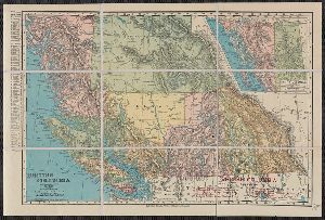
- No349
Digital Collections Search Results
Container / Volume
BRBL_00389
Published / Created
[c1925].
Call Number
739 1925
Format
Digital Collection / Online / Cartographic / Maps & GIS
Access
Public

Creator
British Columbia. Dept. of Lands
Container / Volume
BRBL_00392
Published / Created
c1933.
Call Number
739G 1933
Format
Digital Collection / Online / Cartographic / Maps & GIS
Access
Public
Alternative Title
Map (British Columbia. Dept. of Lands) ; no. 1H. and Map / British Columbia Department of Lands ; no. 1H
Publisher
British Columbia Dept. of Lands,
Subject (Topic)
Mines and mineral resources--British Columbia--Maps

Creator
British Columbia. Dept. of Lands
Container / Volume
BRBL_00392
Published / Created
1929
Call Number
739G 1929C
Format
Digital Collection / Online / Cartographic / Maps & GIS
Access
Public

Container / Volume
BRBL_00393
Description
"Rand, McNally & Co.'s New Business Atlas Map of British Columbia." Includes inset map: Northern
Published / Created
1909
Call Number
739gme 1909
Format
Digital Collection / Online / Cartographic / Maps & GIS
Access
Public
Creator
British Columbia. Dept. of Lands
Container / Volume
BRBL_00388
Published / Created
1911
Call Number
739 1911B
Format
Digital Collection / Online / Cartographic / Maps & GIS
Access
Public
Subject (Topic)
Railroads--British Columbia--Maps

Creator
British Columbia. Dept. of Lands
Container / Volume
BRBL_00388
Published / Created
1913
Call Number
739 1913B
Format
Digital Collection / Online / Cartographic / Maps & GIS
Access
Public
Subject (Topic)
Public lands--British Columbia--Maps

Creator
British Columbia. Dept. of Lands
Container / Volume
BRBL_00389
Published / Created
1942
Call Number
739 1942
Format
Digital Collection / Online / Cartographic / Maps & GIS
Found In
Access
Public
Subject (Topic)
Administrative and political divisions--British Columbia--Maps

Creator
British Columbia. Dept. of Lands
Container / Volume
BRBL_00392
Published / Created
1925
Call Number
739G 1925
Format
Digital Collection / Online / Cartographic / Maps & GIS
Found In
Access
Public

Creator
Royal Geographical Society (Great Britain)
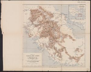
Container / Volume
BRBL_00023A
Published / Created
1908
Call Number
26912 1908A
Format
Digital Collection / Online / Cartographic / Maps & GIS
Access
Public
Container / Volume
BRBL_00040
Published / Created
1788
Call Number
319 1788
Format
Digital Collection / Online / Cartographic / Maps & GIS
Access
Public
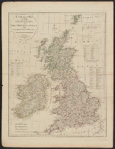
Creator
Fisher, Steven
Container / Volume
BRBL_00389
Description
"This map is from British Columbia's coast (the Canadian inside passage), Alaska Geographic, volume
Published / Created
c1986.
Call Number
739 1986
Format
Digital Collection / Online / Cartographic / Maps & GIS
Found In
Access
Public
Subject (Topic)
Coasts--British Columbia--Maps

Creator
Edinburgh Geographical Institute and John Bartholomew & Co
Container / Volume
BRBL_00040
Published / Created
[1875?]
Call Number
319 1875
Format
Digital Collection / Online / Cartographic / Maps & GIS
Found In
Access
Public
Subject (Topic)
Railroads--British Isles--Maps

Creator
Canada. Topographical Survey
Container / Volume
BRBL_00391
Published / Created
[1909]
Call Number
739CBF B386 1909
Format
Digital Collection / Online / Cartographic / Maps & GIS
Found In
Access
Public
Alternative Title
Part of the railway belt, British Columbia
Subject (Topic)
Triangulation--British Columbia--Maps

Creator
British Columbia. Dept. of Lands and Forests
Container / Volume
BRBL_00389
Published / Created
1947
Call Number
739 B41 1947
Format
Digital Collection / Online / Cartographic / Maps & GIS
Access
Public
Subject (Topic)
Coasts--British Columbia--Maps

Creator
British Columbia. Dept. of Lands and Forests
Container / Volume
BRBL_00389
Published / Created
1947
Call Number
739 G86 1947
Format
Digital Collection / Online / Cartographic / Maps & GIS
Found In
Access
Public
Subject (Topic)
Coasts--British Columbia--Maps

Creator
British Columbia. Dept. of Lands and Forests
Container / Volume
BRBL_00389
Published / Created
1943
Call Number
739 B41 1943
Format
Digital Collection / Online / Cartographic / Maps & GIS
Access
Public
Subject (Topic)
Coasts--British Columbia--Maps

Creator
Wyld, James, 1812-1887
Container / Volume
BRBL_00040
Published / Created
[187-?]
Call Number
319 1872
Format
Digital Collection / Online / Cartographic / Maps & GIS
Found In
Access
Public
Subject (Topic)
Geology--British Isles--Maps

Creator
H.M. Gousha Company
Container / Volume
BRBL_00393
Description
Idaho, and northwestern Montana. At head of title: Shell. Directory of radio stations in British
Published / Created
1939
Call Number
739gmb 1939
Format
Digital Collection / Online / Cartographic / Maps & GIS
Access
Public
Alternative Title
Shell road map, British Columbia
Subject (Topic)
Roads--British Columbia--Maps

Creator
Canada. Dept. of the Interior
Container / Volume
BRBL_00389
Published / Created
1923
Call Number
739 G45 1923
Format
Digital Collection / Online / Cartographic / Maps & GIS
Access
Public

Creator
British Columbia. Dept. of Lands
Container / Volume
BRBL_00388
Published / Created
1912
Call Number
739 1912R
Format
Digital Collection / Online / Cartographic / Maps & GIS
Found In
Access
Public

Creator
British Columbia. Dept. of Lands and Works
Container / Volume
BRBL_00391
Published / Created
1903
Call Number
739 Y12 1903
Format
Digital Collection / Online / Cartographic / Maps & GIS
Found In
Access
Public
Subject (Topic)
Mining districts--British Columbia--Maps

Creator
Rand McNally and Company
Container / Volume
BRBL_00388
Description
"British Columbia Railroads"--Lower right corner. "Copyright, 1895, by Rand, McNally & Co." "Rand
Published / Created
1898
Call Number
739 1898A
Format
Digital Collection / Online / Cartographic / Maps & GIS
Found In
Access
Public
Alternative Title
Rand, McNally & Co.'s indexed indexed atlas of the world map of British Columbia
Subject (Topic)
Mining districts--British Columbia--Maps

Creator
Edward Stanford Ltd
Container / Volume
BRBL_00023B
Published / Created
1903
Call Number
2732 1903
Format
Digital Collection / Online / Cartographic / Maps & GIS
Found In
Access
Public
Publisher
Published by Edward Stanford for the British North Borneo Company,
Subject (Name)
British North Borneo Chartered Company

Creator
Canada. Dept. of the Interior
Container / Volume
BRBL_00393
Published / Created
1913
Call Number
739gme 1913
Format
Digital Collection / Online / Cartographic / Maps & GIS
Found In
Access
Public
Subject (Topic)
Land tenure--British Columbia--Maps

Container / Volume
BRBL_00042
Published / Created
1908
Call Number
319gm 1908
Format
Digital Collection / Online / Cartographic / Maps & GIS
Found In
Access
Public
