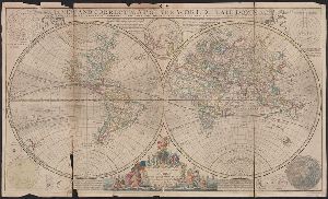
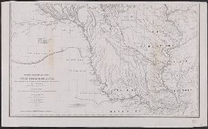
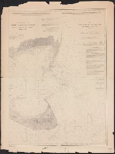
- No134
Creator
United States. Dept. of State
Container / Volume
BRBL_00264
Published / Created
1947
Call Number
48es 1947
Format
Digital Collection / Online / Cartographic / Maps & GIS
Access
Public
Call Number
1977 +392
Format
Digital Collection / Online / Images / Maps & GIS
Access
Public
Call Number
1977 +392
Format
Digital Collection / Online / Cartographic / Maps & GIS
Access
Public
Container / Volume
BRBL_00473
Published / Created
1891
Call Number
766 N46 1891
Format
Digital Collection / Online / Cartographic / Maps & GIS
Found In
Access
Public

Creator
Pierce, F. E. (Frederick Erastus), 1878-1935
Container / Volume
BRBL_00493
Published / Created
1894
Call Number
771ea N49 1894
Format
Digital Collection / Online / Cartographic / Maps & GIS
Found In
Access
Public
Container / Volume
BRBL_00499
Published / Created
[1752]
Call Number
774 P53 1752
Format
Digital Collection / Online / Cartographic / Maps & GIS
Found In
Access
Public

Creator
Meyer, Ernest L
Container / Volume
BRBL_00496
Published / Created
1872
Call Number
773 El48 1875
Format
Digital Collection / Online / Cartographic / Maps & GIS
Found In
Access
Public
Container / Volume
BRBL_00509
Published / Created
1864
Call Number
783 1864S
Format
Digital Collection / Online / Cartographic / Maps & GIS
Found In
Access
Public
Creator
Horwood, Richard
Published / Created
1799
Call Number
2002 Folio 93
Format
Digital Collection / Online / Cartographic / Maps & GIS
Found In
Access
Public
Container / Volume
BRBL_00711
Published / Created
1772
Call Number
766 L49 1772
Format
Digital Collection / Online / Cartographic / Maps & GIS
Found In
Access
Public

Creator
Berry, William, fl. 1669-1708, creator and Sanson, Nicolas, 1600-1667
Published / Created
1688
Call Number
1973 Folio 10
Format
Digital Collection / Online / Cartographic / Maps & GIS
Found In
Access
Public
Creator
New Hampshire. Dept. of Agriculture
Container / Volume
BRBL_00451
Published / Created
1910
Call Number
762cbf 1910
Format
Digital Collection / Online / Cartographic / Maps & GIS
Found In
Access
Public
Call Number
1977 +392
Format
Digital Collection / Online / Cartographic / Maps & GIS
Found In
Access
Public
Creator
Van Loan, Walton
Container / Volume
BRBL_00481
Published / Created
1877
Call Number
771 C29 1877
Format
Digital Collection / Online / Cartographic / Maps & GIS
Found In
Access
Public
Subject (Name)
Catskill Mountain House (Hotel)--Maps
Creator
Geographia Map Company
Container / Volume
BRBL_00589
Published / Created
[194-?]
Call Number
834 D437 1948
Format
Digital Collection / Online / Cartographic / Maps & GIS
Found In
Access
Public

Creator
Huber, Emil
Container / Volume
BRBL_00390
Published / Created
1905
Call Number
739 Se48 1905C
Format
Digital Collection / Online / Cartographic / Maps & GIS
Found In
Access
Public
Creator
Burr, David H., 1803-1875
Container / Volume
BRBL_00478
Published / Created
1839]
Call Number
771 1839
Format
Digital Collection / Online / Cartographic / Maps & GIS
Found In
Access
Public
Container / Volume
BRBL_00499
Published / Created
[1820]
Call Number
774 M319 1820
Format
Digital Collection / Online / Cartographic / Maps & GIS
Found In
Access
Public

Creator
Morgan, Lewis Henry, 1818-1881
Container / Volume
BRBL_00370
Published / Created
1851]
Call Number
71 1851
Format
Digital Collection / Online / Cartographic / Maps & GIS
Found In
Access
Public
Creator
Bloomer, W. L
Container / Volume
BRBL_00562
Published / Created
c1887
Call Number
816 K134 1887
Format
Digital Collection / Online / Cartographic / Maps & GIS
Found In
Access
Public
Creator
United States. Army. Corps of Topographical Engineers
Container / Volume
BRBL_00553
Published / Created
[1858]
Call Number
811 Sa22 1858
Format
Digital Collection / Online / Cartographic / Maps & GIS
Found In
Access
Public
Container / Volume
BRBL_00512
Description
no. 3. White House to Harrison's Landing.
Published / Created
1863
Call Number
783hc 1863W
Format
Digital Collection / Online / Cartographic / Maps & GIS
Found In
Access
Public

Creator
House & Brown
Container / Volume
BRBL_00646
Description
"Entered according to act of Congress in the year 1847 by House & Brown ...." Includes distance
Published / Created
1851
Call Number
88 1851
Format
Digital Collection / Online / Cartographic / Maps & GIS
Found In
Access
Public
Publisher
House & Brown,
Creator
House & Brown
Container / Volume
BRBL_00645
Description
"Entered according to act of Congress in the year 1847 by House & Brown ...." Insets: Plan
Published / Created
1847?]
Call Number
88 1847J
Format
Digital Collection / Online / Cartographic / Maps & GIS
Found In
Access
Public
Publisher
House & Brown?,
Creator
United States. Congress. House. Committee on the Public Lands
Container / Volume
BRBL_00406
Published / Created
[1878?].
Call Number
75 1878
Format
Digital Collection / Online / Cartographic / Maps & GIS
Found In
Access
Public

Creator
Hood, Washington
Container / Volume
BRBL_00532
Description
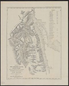
West, 405. Covers lands in the Great Plains. From United States Congress, House Committee on Indian
Published / Created
1834]
Call Number
80 1834
Format
Digital Collection / Online / Cartographic / Maps & GIS
Access
Public
Alternative Title
United States. Congress. House. Report ; 23rd Congress, 1st session, 474.
Subject (Name)
Gales & Seaton and United States. Congress. House. Committee on Indian Affairs. Regulating the Indian Department

Creator
Hood, Washington
Container / Volume
BRBL_00532
Description
, House Committee on Indian Affairs's Regulating the Indian Department. Washington, D.C.: Gales & Seaton
Published / Created
1834]
Call Number
80 1834
Format
Digital Collection / Online / Cartographic / Maps & GIS
Access
Public
Alternative Title
United States. Congress. House. Report ; 23rd Congress, 1st session, 474.
Subject (Name)
Gales & Seaton and United States. Congress. House. Committee on Indian Affairs. Regulating the Indian Department

Description
of the House of Commons upon the improvement of the Port of London". "The yellow line includes the space
Published / Created
Novr. 1800.
Call Number
Small 32 L84 1666
Format
Digital Collection / Online / Cartographic / Maps & GIS
Found In
Access
Public
Subject (Name)
Delamotte, William, 1775-1863., Great Britain. Parliament. House of Commons. Select Committee Appointed to Consider Evidence Taken, and Hansard, Luke, 1752-1828
Container / Volume
BRBL_00645
Published / Created
1849
Call Number
88 1849
Format
Digital Collection / Online / Cartographic / Maps & GIS
Found In
Access
Public
Publisher
House & Brown,
Creator
Burr, David H., 1803-1875
Container / Volume
BRBL_00547
Published / Created
[1839?]
Call Number
806 1839
Format
Digital Collection / Online / Cartographic / Maps & GIS
Found In
Access
Public
Publisher
Geographer to the House of Representatives of the U.S.,
Container / Volume
BRBL_00067
Description
Preliminary record. View: Burley House.
Published / Created
1831
Call Number
3251 1831
Format
Digital Collection / Online / Cartographic / Maps & GIS
Found In
Access
Public
Container / Volume
BRBL_00061
Description
Preliminary record. View of Stowe House.
Published / Created
1834
Call Number
3227 1834
Format
Digital Collection / Online / Cartographic / Maps & GIS
Found In
Access
Public
Container / Volume
BRBL_00523
Description
in House doc. 9, 31st Congress, 2nd session, 1850. At head of title: (I).
Published / Created
1850?]
Call Number
795fcm 1850
Format
Digital Collection / Online / Cartographic / Maps & GIS
Found In
Access
Public
Alternative Title
House document (United States. Congress. House) ; 31st Congress, 2nd session, no. 9.

Creator
United States. Surveyor General
Container / Volume
BRBL_00575
Description
"House Ex. Doc. no. 1, 37th. Cong., 3d. Sess." [Serial set v. 1160] At head of title: (8) Shows
Published / Created
1862?]
Call Number
825fcm 1862
Format
Digital Collection / Online / Cartographic / Maps & GIS
Found In
Access
Public
Alternative Title
House executive document (United States. Congress. House) ; 37th Congress, 3rd session, no. 1.

Creator
United States. General Land Office
Container / Volume
BRBL_00615
Description
"House R. Ex. Doc. No. 1, 38th Cong., 1st Sess." Includes "List of private grants finally surveyed
Published / Created
1866
Call Number
844fcm 1866
Format
Digital Collection / Online / Cartographic / Maps & GIS
Found In
Access
Public
Alternative Title
House executive document (United States. Congress. House) ; 38th Congress, 1st session, no. 1.

Container / Volume
BRBL_00731
Description
"Published by order of the U.S. House of Representatives."
Published / Created
[1843]
Call Number
807 1843
Format
Digital Collection / Online / Cartographic / Maps & GIS
Found In
Access
Public
Container / Volume
BRBL_00454
Description
City map shows the "Powder House" pictorially.
Published / Created
178-?]
Call Number
764 B65 1774
Format
Digital Collection / Online / Cartographic / Maps & GIS
Found In
Access
Public
Container / Volume
BRBL_00549
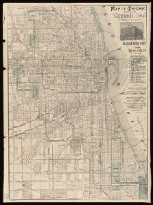
Description
Shows mileage from Chicago court house.
Published / Created
1887
Call Number
806gme C43 1887
Format
Digital Collection / Online / Cartographic / Maps & GIS
Found In
Access
Public

Creator
United States. Surveyor General
Container / Volume
BRBL_00561
Published / Created
1862
Call Number
815fcm 1862
Format
Digital Collection / Online / Cartographic / Maps & GIS
Found In
Access
Public
Alternative Title
House document (United States. Congress. House) ; 37th Congress, 3rd session, no. 1. and House. Ex. Doc. No. I. 37th Cong. 3rd Sess.

Creator
Derby, George Horatio, 1823-1861
Container / Volume
BRBL_00615
Description
Appears in U.S. 31st Cong., 1st Sess., 1850, House Ex. Doc. no. 17. Message to the President
Published / Created
1850]
Call Number
844gfc 1849
Format
Digital Collection / Online / Cartographic / Maps & GIS
Found In
Access
Public
Alternative Title
House executive document (United States. Congress. House) ; 31st Congress, 1st session, no. 17. and Map of General Riley's route, 1849.

Creator
United States. Department of the Treasury. Bureau of Statistics
Container / Volume
BRBL_00648
Published / Created
1884]
Call Number
88gme 1884
Format
Digital Collection / Online / Cartographic / Maps & GIS
Found In
Access
Public
Alternative Title
H. Ex. ; 86, 1, 48 and House executive document (United States. Congress. House) ; 48th Congress, 1st session, no. 86.

Creator
Di tu chu ban she
Container / Volume
BRBL_00296
Published / Created
[1982]
Call Number
56 K962 1982
Format
Digital Collection / Online / Cartographic / Maps & GIS
Access
Public
Publisher
Cartographic Pub. House : and Distributed by China International Book Trading Corp.,
Creator
Abbot, Henry L
Container / Volume
BRBL_00511
Description
no. 1. Yorktown to Williamsburg -- no. 2. Williamsburg to White House -- no. 3. White House
Published / Created
1862]
Call Number
783hc 1862F
Format
Digital Collection / Online / Cartographic / Maps & GIS
Found In
Access
Public
Container / Volume
BRBL_00548
Description
Adv. for "Wilde's Clothing House". Ms. notation "43rd and Indiana Ave."
Published / Created
1907
Call Number
806 C43 1907
Format
Digital Collection / Online / Cartographic / Maps & GIS
Found In
Access
Public
Container / Volume
BRBL_00046
Description
Inset: Listing of churches, chapels, & meeting houses, public buildings, etc. Preliminary record.
Published / Created
1800
Call Number
32 B77 1800
Format
Digital Collection / Online / Cartographic / Maps & GIS
Found In
Access
Public
Creator
United States. Surveyor General
Container / Volume
BRBL_00601
Published / Created
1858]
Call Number
844 1858B
Format
Digital Collection / Online / Cartographic / Maps & GIS
Found In
Access
Public
Alternative Title
House executive document (United States. Congress. House) ; 35th Congress, 2nd session, no. 2. and Senate executive document (United States. Congress. Senate) ; 35th Congress, 2nd session, no. 1.

Container / Volume
BRBL_00481
Description
Geo. Hayward, N.Y., Lith. Gives houses and names of owners, position of boats, streets and names.
Published / Created
1858
Call Number
771 B796 1776
Format
Digital Collection / Online / Cartographic / Maps & GIS
Found In
Access
Public
Container / Volume
BRBL_00712
Description
Color: pen and ink. Notes: drawings of a rooster, house, trees and rabit in left and right hand
Published / Created
1786
Call Number
766 Si5 1786
Format
Digital Collection / Online / Cartographic / Maps & GIS
Found In
Access
Public
Creator
Lotter, Matthäus Albrecht, 1741-1810
Container / Volume
BRBL_00730
Description
Based on surveys made by N. Scull and G. Heap. Hand-colored. Inset: Elevation of the state house.
Published / Created
1777
Call Number
774 P53 1777L
Format
Digital Collection / Online / Cartographic / Maps & GIS
Found In
Access
Public

Creator
Poppleton, Thomas H.
Container / Volume
BRBL_00485
Description
right, with some loss of text. Relief shown by hachures. Shows wards, ferry lines, house numbers
Published / Created
1829
Call Number
771 N49 1829
Format
Digital Collection / Online / Cartographic / Maps & GIS
Found In
Access
Public
Creator
United States. Army. Corps of Engineers
Container / Volume
BRBL_00508
Description
, houses, names of residents, and drainage.
Published / Created
1862
Call Number
783 1862W
Format
Digital Collection / Online / Cartographic / Maps & GIS
Found In
Access
Public
Creator
Berry, William, fl. 1669-1708, creator and Sanson, Nicolas, 1600-1667
Published / Created
[ca. 1686]
Call Number
1973 Folio 10
Format
Digital Collection / Online / Cartographic / Maps & GIS
Found In
Access
Public
Alternative Title
Empire of Germany in which are distinguished the dominions of the house of Austria

Creator
Moll, Herman, -1732
Container / Volume
BRBL_00682
Description
-two maps. [London] : Printed for Tho: Bowles next ye Chapter House in St. Pauls Church Yard, & John Bowles
Published / Created
[1736?]
Call Number
18 1739
Format
Digital Collection / Online / Cartographic / Maps & GIS
Found In
Access
Public
Publisher
Printed for Tho. Bowles next the Chapter house in St. Pauls church yard & Iohn Bowles at the Black
Container / Volume
BRBL_00076
Description
"Ordered by the House of Commons to be printed 1st, August, 1836." In upper right corner "2." Title
Call Number
32gme L84 1836
Format
Digital Collection / Online / Cartographic / Maps & GIS
Found In
Access
Public
Creator
Abbot, Henry L
Container / Volume
BRBL_00511
Description
no. 1. Yorktown to Williamsburg -- no. 2. Williamsburg to White House -- no. 3. White House
Published / Created
1862
Call Number
783hc 1862E
Format
Digital Collection / Online / Cartographic / Maps & GIS
Found In
Access
Public
Creator
United States. Post Office Dept
Container / Volume
BRBL_00475A
Description
"768"--Lower right margin. Blueprint. Indicates lettered routes, post offices, houses, schools
Published / Created
1919
Call Number
766gmd M58 1919
Format
Digital Collection / Online / Cartographic / Maps & GIS
Found In
Access
Public
Creator
Moll, Herman, -1732
Container / Volume
BRBL_00696
Published / Created
[1736]
Call Number
867 1729
Format
Digital Collection / Online / Cartographic / Maps & GIS
Found In
Access
Public
Publisher
Printed and sold by Tho. Bowles, next ye Chapter House in St. Pauls Church yard & I. Bowles
Creator
Kroll Map Company, inc
Container / Volume
BRBL_00627
Description
lines, main thoroughfares, railroads, and house numbers.
Published / Created
c1924.
Call Number
847 Se18 1924
Format
Digital Collection / Online / Cartographic / Maps & GIS
Access
Public
Container / Volume
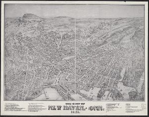
BRBL_00474
Description
A view of New Haven. Has list of 51 important places. Indexed. Shows buildings, trees, houses
Published / Created
1879
Call Number
766am N46 1879V
Format
Digital Collection / Online / Cartographic / Maps & GIS
Access
Public

Container / Volume
BRBL_00474
Description
A view of New Haven. Has list of 51 important places. Indexed. Shows buildings, trees, houses
Published / Created
1879
Call Number
766am N46 1879V
Format
Digital Collection / Online / Cartographic / Maps & GIS
Access
Public
Creator
United States. Army. Corps of Engineers
Container / Volume
BRBL_00381
Description
variations" table, "Light-houses", "Authorities" and "Water table."
Published / Created
[1875]
Call Number
7345cea 1875A
Format
Digital Collection / Online / Cartographic / Maps & GIS
Found In
Access
Public
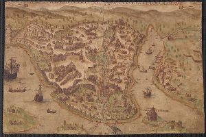
Container / Volume
BRBL_00707
Description
consists of houses and manors and ships upon the body of the city.
Published / Created
[1576]
Call Number
491 Is7 1576
Format
Digital Collection / Online / Cartographic / Maps & GIS
Found In
Access
Public
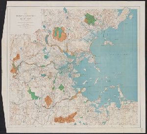
Creator
Massachusetts. Metropolitan Park Commission
Container / Volume
BRBL_00456
Description
"Contour interval 20 feet." "Dated January 2d 1893." From: House No. 150, Report of the Board
Published / Created
1893
Call Number
764 B65 1893
Format
Digital Collection / Online / Cartographic / Maps & GIS
Found In
Access
Public
Creator
Cope, Emmor B
Container / Volume
BRBL_00500
Description
, showing roads, railroads, field patterns, woodland, observation towers, monuments, and houses.
Published / Created
1919
Call Number
774AM G33 1919
Format
Digital Collection / Online / Cartographic / Maps & GIS
Found In
Access
Public
Creator
Society for the Diffusion of Useful Knowledge (Great Britain)
Description
, churches & chapels" and illustrations of Writers Buildings, Government House and Esplanade Row. Oriented
Published / Created
Novr. 1842.
Call Number
BrSides Folio 2019 94
Format
Digital Collection / Online / Cartographic / Maps & GIS
Found In
Access
Public
Creator
Sanborn Map Company
Abstract
Fire insurance map, colored to show building construction, property boundaries and house and block
Container / Volume
BRBL_00502
Published / Created
[1918]
Call Number
766 W688 1918
Format
Digital Collection / Online / Cartographic / Maps & GIS
Access
Public
Creator
Lay, Amos, 1765-1851
Container / Volume
BRBL_00379
Description
Also shows district, county, and township boundaries, mills, iron works, court houses, and churches
Published / Created
[1814?]
Call Number
734 1814
Format
Digital Collection / Online / Cartographic / Maps & GIS
Found In
Access
Public
Creator
Sanborn Map Company
Abstract
Fire insurance map, colored to show building construction, property boundaries and house and block
Container / Volume
BRBL_00502
Published / Created
August, 1923.
Call Number
776 B764 1923
Format
Digital Collection / Online / Cartographic / Maps & GIS
Access
Public
Creator
Sanborn Map Company
Abstract
Fire insurance map, colored to show building construction, property boundaries and house and block
Container / Volume
BRBL_00502
Published / Created
June, 1919.
Call Number
776 D75 1919
Format
Digital Collection / Online / Cartographic / Maps & GIS
Access
Public
Creator
Sanborn Map Company
Abstract
Fire insurance map, colored to show building construction, property boundaries and house and block
Container / Volume
BRBL_00502
Published / Created
October, 1919.
Call Number
776 G295 1919
Format
Digital Collection / Online / Cartographic / Maps & GIS
Access
Public
Creator
Sanborn Map Company
Abstract
Fire insurance map, colored to show building construction, property boundaries and house and block
Container / Volume
BRBL_00502
Published / Created
Nov. 1919.
Call Number
776 M59 1919
Format
Digital Collection / Online / Cartographic / Maps & GIS
Access
Public
Creator
Sanborn Map Company
Abstract
Fire insurance map, colored to show building construction, property boundaries and house and block
Container / Volume
BRBL_00502
Published / Created
August, 1915.
Call Number
766 Sm95 1915
Format
Digital Collection / Online / Cartographic / Maps & GIS
Access
Public
Creator
Sanborn Map Company
Abstract
Fire insurance map, colored to show building construction, property boundaries and house and block
Container / Volume
BRBL_00502
Published / Created
July, 1923.
Call Number
776 N642 1923
Format
Digital Collection / Online / Cartographic / Maps & GIS
Access
Public
Creator
United States. Far East Command
Container / Volume
BRBL_00304
Description
installations, dependent housing, visitor's aids, and ill. on verso.
Published / Created
1947
Call Number
57 T578 1947
Format
Digital Collection / Online / Cartographic / Maps & GIS
Found In
Access
Public
Creator
Smith, John L., 1846-1921
Container / Volume
BRBL_00641
Description
--Province of Havana. Relief shown by hachures. Shows railroads, provinces, roads, light houses, and territory held
Published / Created
1897
Call Number
855 1897B
Format
Digital Collection / Online / Cartographic / Maps & GIS
Access
Public

Description
with a section plan of the underground workings." Includes illustrations of boarding house and assay office.
Published / Created
[between 1870 and 1879?]
Call Number
BrSides Folio 2018 125
Format
Digital Collection / Online / Cartographic / Maps & GIS
Found In
Access
Public

Creator
Peseux, M
Container / Volume
BRBL_00541
Description
shows troop positions, roads, railroads, hachures, drainage, vegetation, and rural houses. Streets
Published / Created
1864
Call Number
801hc N17 1864
Format
Digital Collection / Online / Cartographic / Maps & GIS
Found In
Access
Public
Container / Volume
BRBL_00463
Description
, light houses and beacons, light vessels, variations of magnetic needle, tides, and two views.
Published / Created
1860
Call Number
7645cea 1860
Format
Digital Collection / Online / Cartographic / Maps & GIS
Found In
Access
Public
Creator
Wadsworth, James, 1730-1817
Container / Volume
BRBL_00469A
Description
individual houses with owners' names and professions. Includes table of first grantees, keyed to numbered
Published / Created
[1865?]
Call Number
766 N46 1748Z
Format
Digital Collection / Online / Cartographic / Maps & GIS
Found In
Access
Public

Creator
Reed and Barber
Container / Volume
BRBL_00400
Description
Colored by state and territory. Engraved vignettes of the Capitol and the Presidents House. In 2
Published / Created
1850
Call Number
75 1850J
Format
Digital Collection / Online / Cartographic / Maps & GIS
Found In
Access
Public
Description
of property owners and property lines given. No buildings except the meeting house on the green.
Published / Created
1880
Call Number
Small 766 N46 1641
Format
Digital Collection / Online / Cartographic / Maps & GIS
Access
Public
Container / Volume
BRBL_00448
Description
showing divisions, ranges and lots, roads, railroads, sites of houses prior to 1800, etc.
Published / Created
1871
Call Number
761 B98 1870
Format
Digital Collection / Online / Cartographic / Maps & GIS
Access
Public
Creator
United States. Army. Corps of Topographical Engineers
Container / Volume
BRBL_00510
Description
"piece torn from la Includes county names and boundaries, additional villages, and a few houses
Published / Created
[1863?]
Call Number
783 P856 1863
Format
Digital Collection / Online / Cartographic / Maps & GIS
Found In
Access
Public
Creator
Newbery, F. T
Container / Volume
BRBL_00539
Description
, 1877. At bottom of text: Printed at the Omaha Republican Steam Book and Job Printing House, Omaha, Neb
Published / Created
1877?]
Call Number
80gme 1875
Format
Digital Collection / Online / Cartographic / Maps & GIS
Found In
Access
Public
Container / Volume
BRBL_00510
Description
,3,5,6 Corps surrounding Court House. Relief shown by hachures. Title supplied by cataloger.
Published / Created
1863
Call Number
783 C899 1863
Format
Digital Collection / Online / Cartographic / Maps & GIS
Found In
Access
Public
Creator
Barber, Bissell B
Container / Volume
BRBL_00398
Description
Vignettes of White House and Capitol; table showing city populations according to 1830 Census
Published / Created
1835
Call Number
75 1835A
Format
Digital Collection / Online / Cartographic / Maps & GIS
Found In
Access
Public
Creator
L'Isle, Guillaume de, 1675-1726
Container / Volume
BRBL_00684
Description
and settlements, with references to types of religious houses.
Published / Created
1713
Call Number
3825 1713
Format
Digital Collection / Online / Cartographic / Maps & GIS
Found In
Access
Public

Creator
Scull, Nicholas, 1686?-1761?
Description
. 373. Includes table of distances "The distances of particular places in this map, from the court house
Published / Created
[1753]
Call Number
BrSides 2019 61
Format
Digital Collection / Online / Cartographic / Maps & GIS
Found In
Access
Public

Creator
United States. Army. Corps of Engineers
Container / Volume
BRBL_00304
Description
"Reprinted without revision April 1947." On verso: index to houses for dependents of military
Published / Created
1947
Call Number
57 T578 1946A
Format
Digital Collection / Online / Cartographic / Maps & GIS
Found In
Access
Public

Creator
Dearborn, Benjamin, 1754-1838
Container / Volume
BRBL_00455
Description
-Press, lately invented by Benjamin Dearborn." Removed from Massachusetts House Document no. 18 of June 1814
Published / Created
[1814]
Call Number
764 B65 1814A
Format
Digital Collection / Online / Cartographic / Maps & GIS
Found In
Access
Public

Container / Volume
BRBL_00495
Description
, color added by hand. River, streams, swamps, roads, houses, woods; elevations in stippled hachuring
Published / Created
1784
Call Number
771hc H864 1777A
Format
Digital Collection / Online / Cartographic / Maps & GIS
Found In
Access
Public
Container / Volume
BRBL_00304
Description
roads, waterways, houses, post offices and ports. Unzen and neighbourhood -- Sea routes with Nagasaki
Published / Created
1922
Call Number
57 Un9 1921
Format
Digital Collection / Online / Cartographic / Maps & GIS
Access
Public
Creator
Lindenkohl, A
Container / Volume
BRBL_00509
Description
Covers the area from Norfolk north to Lancaster Court House and west past Richmond and Petersburg
Published / Created
1862?]
Call Number
783 1863E
Format
Digital Collection / Online / Cartographic / Maps & GIS
Found In
Access
Public
Creator
Palliser, John, 1807-1887
Container / Volume
BRBL_00388
Description
"To accompany 'The Journals, detailed reports, & observations' presented to both Houses
Published / Created
[1968?]
Call Number
739 1857
Format
Digital Collection / Online / Cartographic / Maps & GIS
Found In
Access
Public
Creator
Scull, Nicholas, 1686?-1761?
Description
. 373. Includes table of distances "The distances of particular places in this map, from the court house
Published / Created
[1753]
Call Number
BrSides 2019 60
Format
Digital Collection / Online / Cartographic / Maps & GIS
Found In
Access
Public

Creator
Wheeler, A. O. (Arthur Oliver), 1860-1945
Container / Volume
BRBL_00390
Description
"Arthur O. Wheeler, Alpine Club House, Baniff 10th July 1912." Ancillary map titled: Map showing
Published / Created
1912
Call Number
739 M86 1911
Format
Digital Collection / Online / Cartographic / Maps & GIS
Found In
Access
Public

Creator
Graham, J. D. (James Duncan), 1799-1865
Container / Volume
BRBL_00456A
Description
of the House of Representatives of the U. States, and under the direction of the Bureau of Topographical
Published / Created
1836
Call Number
764 C172 1836
Format
Digital Collection / Online / Cartographic / Maps & GIS
Found In
Access
Public
Container / Volume
BRBL_00502
Description
Engraved map showing bodies of water, roads, houses, trees; elevations hachured. Positions
Published / Created
1784
Call Number
774hc G22 1777
Format
Digital Collection / Online / Cartographic / Maps & GIS
Found In
Access
Public

Container / Volume
BRBL_00537
Description
"No I." "To accompany a report in reply to a resolution of the House of Representatives dated Feb
Published / Created
1885]
Call Number
80gc 1884
Format
Digital Collection / Online / Cartographic / Maps & GIS
Found In
Access
Public

Creator
Moll, Herman, -1732
Container / Volume
BRBL_00680
Published / Created
[1729?]
Call Number
11 1724
Format
Digital Collection / Online / Cartographic / Maps & GIS
Found In
Access
Public
Publisher
. Bowles map & print seller next to ye Chapter house in St. Paul's Church yard, and by P. Overton map